
Basin Modelling
The greater Vancouver region is located within a Late-Cretaceous sedimentary basin, called the Georgia basin. It is a northwest-southeast trending depression from the southern tip of Texada Island, stretching beneath the Strait of Georgia, to Bellingham, Washington. Basin modelling refers to performing three-dimensional (3D) wave propagation simulations of many different earthquake ruptures to evaluate how the sedimentary Georgia basin will affect earthquake shaking in the region.
Data Required
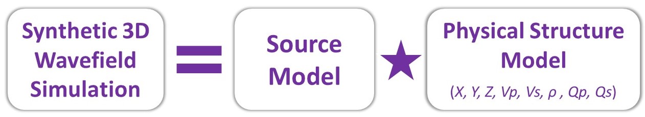
- 3D wave propagation algorithm(s) (software)
- 3D model(s) of subsurface geology and its viscoelastic properties (Vp, Vs, ρ, Qp, Qs)
- Many earthquake source models that include rupture characteristics (slip or stress distribution) for probable future large earthquakes in the region
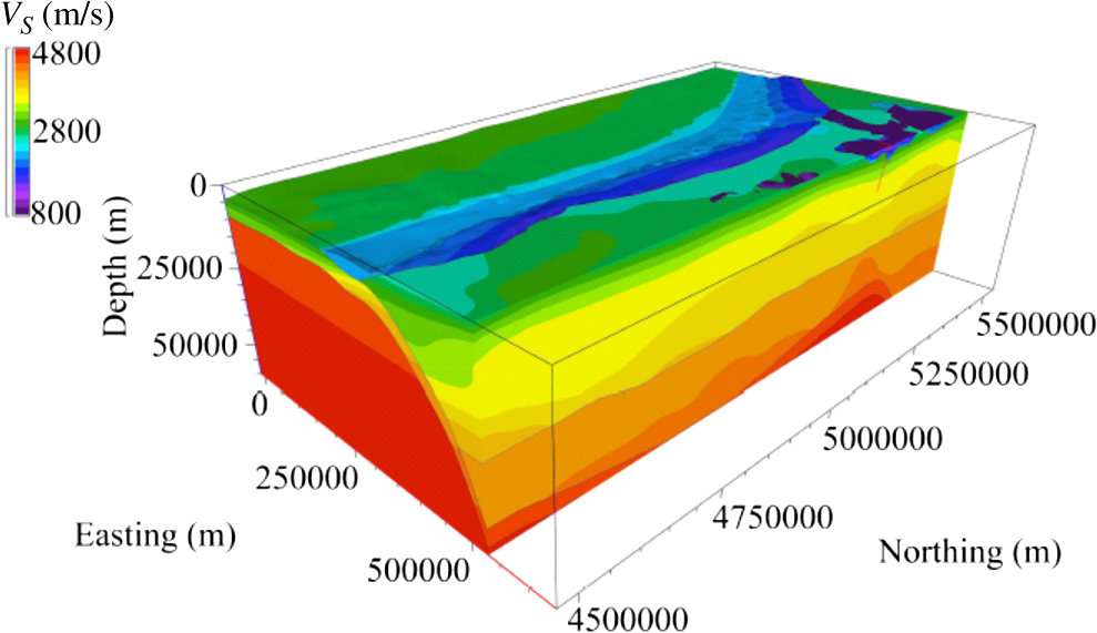 |
Cut-away view of the 3D velocity model of VS from Cape Mendocino, California, to Vancouver Island, British Columbia, showing the subducting slab. The deep sedimentary basins (Georgia, Seattle, and Tacoma) are in the upper right (northeast portion of the model). Figure from Delorey et al. (2014). |
Methodology
- Develop source rupture models for large magnitude scenario earthquakes
- Update 3D physical structure (basin) model using the geodatabase and recent studies of crustal velocities in the region
- Perform 3D wave propagation simulations to generate long-period shaking estimates and stochastic finite-fault modeling to generate shorter-period shaking estimates
- Generate broad-band earthquake shaking (amplification) estimates by merging short- and long-period shaking estimates
Anticipated Products
- Characterize and incorporate earthquake basin effects from the sedimentary Georgia basin into the shaking (amplification) hazard map