
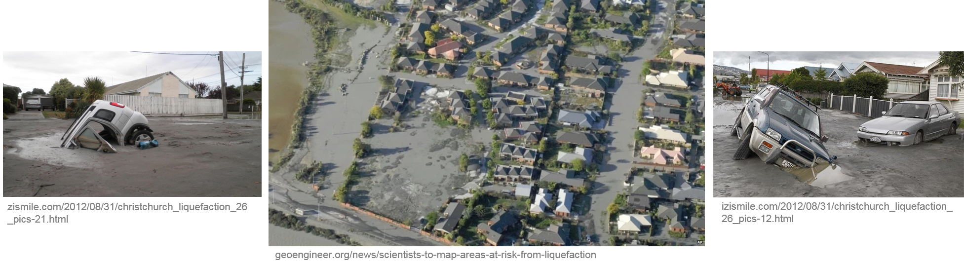
Liquefaction Hazard
Liquefaction is a process by which sediment grains (sand particles) in wet ground are rearranged and water in the pore spaces is squeezed, typically triggered by strong earthquake shaking. Pressure builds forcing the water up through the easiest pathways. The solid ground loses strength and essentially turns into a fluid. The pressurized pore water brings sediment onto the surface as sand boils or volcanoes. The ground surface often tilts and sinks which can damage buildings, roads, pipes and tanks on the liquefied ground. Sometimes the liquefied ground moves sideways, usually towards streams or rivers, which results in lateral spreading. Photos below show post-liquefaction effects in Christchurch, New Zealand after the 2011 M 6.3 earthquake.
Data Required
The two most widely used field-based (in situ) methods to evaluate liquefaction potential are the Cone Penetration Test (CPT) and Standard Penetration Test (SPT). It is becoming more common to also use shear wave velocity (Vs) depth profiling for liquefaction assessment.
Methodology
- Assemble and use surficial geology mapping and groundwater measurements to develop liquefaction susceptibility hazard maps
- Evaluate potential for liquefaction triggering using a stress-based approach which compares earthquake-induced cyclic stress ratios (CSR) with cyclic resistance ratios (CRR) of sediment
- Assemble and use CPT, SPT and Vs measurements from geodatabase to determine CRRs
- Perform equivalent linear and/or nonlinear site response modelling to calculate CSRs
- Determine factor of safety against liquefaction (FoS = CRR/CSR)
- Determine liquefaction potential or probability of liquefaction severity based on the factor of safety against liquefaction and in consideration of depth of liquefaction
Anticipated Products
- Liquefaction susceptibility map
- Probability of liquefaction potential (severity) map due to earthquake shaking
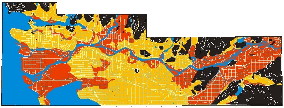
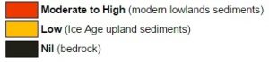
Image above shows a generalized interpretation of liquefaction susceptibility for the Greater Vancouver region (modified after: https://www.cgenarchive.org/vancouver-geomap.html).