
Summary of geotechnical data collection
- Communication with organizations to share available data for summer field campaign planning.
- A Western data sharing agreement was developed and shared with agencies upon request.
There is an ongoing effort to obtain available geodata from agencies and municipalities.
Field data collection
- A two-purpose 5th field campaign was performed over a 9-week period.
- Large-scale ambient vibration arrays of 0.5 to 2 km circumradii using 13 simultaneous recording seismometers were performed at 6 select areas to obtain low frequency (deep depth) dispersion estimates of the soil-till interface (Richmond, Ladner) and the till-rock interface (Burnaby, Coquitlam, Surrey, Vancouver).
- Following the completion of the 6 large-scale arrays, an ambient noise tomography (ANT) survey was performed for two months which involved semi-permanent installation of 19 seismometers (14 short-period and 5 broad-band sensors) to densify the current seismometer networks and thereby improve resolution of a regional 3D Vs model.
Detailed processing and analysis is currently underway.
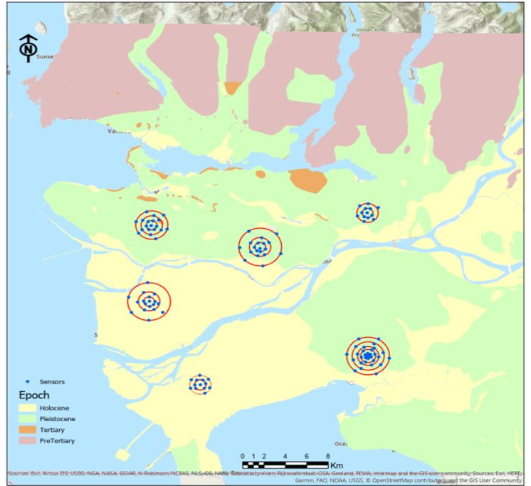
The 6 array measurement configurations and Sensor locations for middle scale array configurations performed across Burnaby, Coquitlam, Ladner, Richmond, Surrey and Vancouver.